
NavVis MLX
Redefining handheld reality capture
NavVis MLX is a user-friendly, handheld dynamic laser scanner that enhances AEC and surveying workflows. As a compact device, it is ideal for confined, smaller spaces or shorter, more frequent scanning on site. This professional handheld device delivers the accuracy and data quality you and your clients require.
Unique benefits

NavVis MLX offers an unrivaled combination of agility, ergonomics, and outstanding data quality from a handheld device. It seamlessly integrates into AEC, surveying, and reality capture workflows both on-site and in-office. An expertly engineered pairing of hardware and software, NavVis MLX delivers comfort and precision in one compact device, excelling in confined or complex environments. For projects requiring swift data capture at exceptional standards, NavVis MLX serves as your steadfast partner in the field and on the go.
A professional-grade tool, designed for seamless accessibility by users of all skill levels. Intuitively engineered, NavVis MLX is an adaptable device that empowers everyone on your team to leverage the benefits of reality capture technology at the highest level.
NavVis MLX is a more affordable, versatile device optimized to seamlessly work hand-in-hand with NavVis VLX in the field and NavVis IVION in the office. Reduce effort and cost of immediate access to reliable as-is and as-built data. This combination offers an end-to-end reality capture solution suitable for various applications and is tailored to empower your stakeholders throughout the workflow.
Differentiate yourself from competition and win more projects with uniquely innovative technology that goes beyond traditional workflows. Stand out from the crowd with a device that boosts efficiency and exceeds client expectations – all without compromising quality.
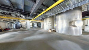
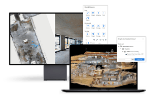
Sample data
See for yourself how NavVis MLX delivers the highest quality point cloud data
from a handheld laser scanning system.


NavVis MLX features
Capture 3D measurements with a 32-layer lidar sensor in combination with industry-trusted SLAM software augmented by Visual Odometry (VO) to deliver exceptional point cloud quality for a handheld device. Four panoramic cameras positioned on top of the system take high-resolution 270º images when resting on the harness and 360º images when lifted above the head.


Monitor your scanning progress in real time with a built-in touchscreen interface, to ensure complete coverage as you move. The screen shows the trajectory and completeness of the scanned environment as you move, ensuring confidence in the data quality.

A one-of-a-kind handheld device with a lightweight and ergonomic design for optimal functionality and usability. Featuring a supporting harness for added comfort, operators can scan as they walk and maneuver freely, ensuring optimal coverage in compact or narrow spaces. The portable design fits easily into a backpack, allowing a single operator to transport and set up the system on the go.
With multiple methods of transporting NavVis MLX, moving around and between sites has never been simpler. A comfortable yet sturdy backpack allows you to move to and from your site with ease and can even be carried as hand luggage on flights. The backpack and rechargeable battery fits snuggly into a protective, hard-shelled case on wheels enabling rail travel and check-in air travel for longer distances.

NavVis MLX takes your AEC and survey workflows to the next level. It’s fully compatible with standard tools in the field and can capture control points measured by Total Stations and GNSS rovers. It supports alignment of datasets as well as national and global coordinates for geo-registration.


How it works

Applications
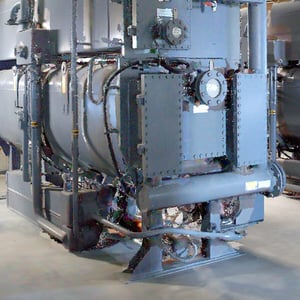
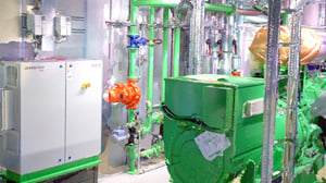
NavVis MLX is an ideal choice for smaller projects, especially on construction sites where environments may be confined, disarrayed, hazardous, or cluttered, and whenever frequent travel or rescanning is required. It perfectly complements the extensive scanning capabilities of NavVis VLX 2 and NavVis VLX 3 in large commercial, residential, or industrial environments.
These systems are compatible with standard tools in the field and can capture control points measured by total stations and GNSS rovers. It supports alignment of datasets as well as national and global coordinates for geo-registration.
.png?width=1263&height=800&name=NavVis-LX-Series-cutout-2%20(1).png)
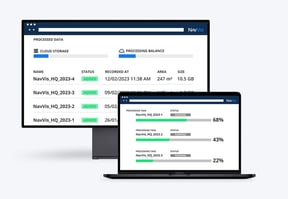
Software

NavVis MLX is optimized to seamlessly work hand-in-hand with NavVis VLX in the field and NavVis IVION in the office. Access reliable as-is and as-built data at a low cost and with minimal effort. This combination offers an end-to-end reality capture solution suitable for various applications and is tailored to empower your stakeholders throughout the workflow.