NavVis, a global leader in mobile mapping and reality capture, and HERE Technologies, the leading location data and services platform, have teamed up to bring high-definition indoor mapping and visual positioning to parking garage operators and transportation hubs.
How does NavVis technology power HERE Indoor Maps?
This partnership leverages three key technologies from NavVis: NavVis mobile mapping systems, NavVis IVION, and NavVis visual positioning technology.
First, NavVis mobile mapping systems are deployed to generate high-definition point cloud data, while also capturing 360 panoramic images. The NavVis mobile mapping devices, such as NavVis VLX, use SLAM (simultaneous localization and mapping) and LiDAR (Laser Imaging, Detection, and Ranging) to produce this data at unprecedented speed without compromising quality.
Once the data is captured, NavVis IVION is used to post-process this data and then as a visualization tool to help convert point cloud data into usable maps and 3D views. Based on this data, HERE creates HD Indoor Maps that include essential attributes like ramp angle, clearance height, and curve radii for specific use cases such as Automated Valet Parking.
Finally, the revolutionary NavVis visual positioning technology is deployed to enable positioning and route-finding capabilities in HERE’s Indoor Maps. Visual positioning is the determination of a position (location and heading) using inputs such as images from a mobile phone camera. It is key for deploying AR solutions at scale without any additional infrastructure such as Bluetooth beacons, WIFI, or QR codes. NavVis’s high-definition point cloud data and its visual positioning technology extend HERE’s outdoor and indoor mapping portfolio and truly allows for seamless end-to-end guidance.
"We’re very pleased to work with NavVis on pushing the frontiers of indoor spatial intelligence. Bringing together NavVis’ high-definition point cloud data, their visual positioning technology and our indoor mapping capabilities, we now can offer clients HD Indoor Maps with true end-to-end guidance and AR functionality without any additional hardware,” said Victor van Dinten, Head of Indoor, Parking and Charging at HERE Technologies.
Listen below as Victor explains how visual positioning will reshape passenger experience in transportation hubs by enabling technologies such as augmented reality:
“We’re very happy to complement the HERE Indoor Map offering with our high-quality, large-scale data, delivered via NavVis IVION and the NavVis IVION API. We look forward to bringing next-generation user experiences to additional spaces such as parking garages and transportation hubs and providing the foundation for meaningful AR solutions at scale,” said Ignacio Pérez Hallerbach, Global Head of Partners & Platform at NavVis.
The joint value is already demonstrated in two customer cases: SBB’s Zurich train station and APCOA parking garages.
SBB: Indoor wayfinding and asset management in a train station
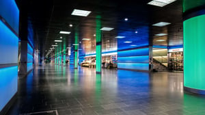
Swiss railway operator, Schweizerische Bundesbahnen SBB AG, was recently announced as an early user of HERE’s Indoor Map as a service. The digital representation of Zurich central station was captured with a NavVis mobile mapping device and then combined with HERE Technologies’ location platform to publish an indoor 3D map. Additionally, an integration with NavVis visual positioning enabled an AR-based wayfinding experience for passengers.
“It’s a common scenario - we hop off our train at a station we’re not familiar with and have to search for the tram, busses or the nearest taxi stand. Precise indoor mapping solutions like those offered by HERE and NavVis will make this a problem of the past,” said Bruno Mario Lochbrunner, Mobility Intrapreneur, at SBB AG.
“Accurate indoor mapping is also a great help to our teams using visual positioning to manage their assets – such as escalators, lamps, bins – as efficiently as possible. We are very impressed by the accuracy and reliability of this technology.”
Indoor Map as a service provides custom mapping, 2D/3D indoor routing, and positioning services to support Augmented Reality and asset tracking use cases. This will help users navigate around stations and find the most efficient transport connections.
Senior Customer Success Manager at HERE Technologies, Michael Schöllhorn, explains this use case and the advantages of visual positioning in greater detail:
APCOA: Indoor parking as the last step of the navigation journey
In addition to the mapping of train stations, another demonstrated use case for HERE and NavVis’s solution is parking garages to start enabling capabilities such as Autonomous Valet Parking (AVP). APCOA has chosen HERE and NavVis to start mapping approximately 3 million square meters of their operated parking garages in Europe.
The indoor maps powered by NavVis point clouds and provided by HERE include key elements of parking garages – individual parking spaces, lanes, ramps, and pedestrian walkways. Using NavVis IVION’s 3D view, HERE builds accurate maps that provide integrated routing for vehicles and pedestrians, with parking garage entrances and exits seamlessly connected to the HERE outdoor street map. This enables end-to-end routing experiences that go beyond the curbside and opens new possibilities for AVP experiences. Additionally, electric-vehicle drivers are able to identify parking spaces on the maps where they can charge their vehicles for maximum convenience.
“We’re delighted to be working with NavVis and HERE on making navigation an end-to-end experience, now including the last missing step: indoor parking garages. That will further improve the customer journey and convenience for our customers,” said Frank van der Sant, Chief Commercial Officer at APCOA.
HERE and NavVis have been recognized by Gartner in its 2021 report "Competitive Landscape: Indoor Mapping." The report specifically highlights the projects that are being carried out with the automotive industry and parking operators to support use cases such as AVP.

