Environment: Urban street - Munich, Germany
Download a sample of NavVis VLX 3 point cloud data in .e57 format and the results of the topographic survey in .dwg format.
About the project
Geosys-Eber Ingenieure is a Munich land surveying office that specializes in classic services such as construction or engineering surveying, and offers services in the areas of mobile mapping and 3D laser scanning.
Together with Tobias Benz from the Geosys-Eber engineers, NavVis recently carried out a topographical survey of Nymphenburger Straße in Munich - with both NavVis VLX and with a classic total station. The aim was to look at and compare the entire workflow and in particular to evaluate the speed, completeness and accuracy of data collection and processing using NavVis technology.
Traditional surveying methods can be challenging and, above all, time-consuming, especially in complex urban environments. This is where SLAM-based laser scanning come into play, offering a more comprehensive, safer and more efficient alternative without compromising the accuracy of the final results.
Site details:
- Size: 6,700 sqm / 72,120 sq ft
- Scanning time: 60 minutes
- Topographic outdoor survey
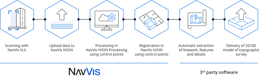
NavVis optimizes your topographic surveying workflows.
From data capture to delivery, NavVis Technology seamlessly integrates with 3rd party hardware & software resulting in a hybrid solution that’s fast, accurate and delivers quality results. Check out the example below for more.