Better together - The NavVis LX-Series Bundle
One professional solution, endless possibilities.
Do you need to scan complex indoor spaces, cover large areas, and frequently rescan without compromising on quality? We have the perfect solution, all bundled into one exciting new offering.
What is the NavVis-LX Series bundle?
The NavVis LX-Series bundle provides surveyors, laser scanning professionals, and AEC teams with a comprehensive solution, featuring the compact NavVis MLX, high-performance NavVis VLX 3, and intuitive NavVis IVION. This versatile toolkit meets diverse scanning and rescanning needs, boosting productivity while maximizing your budget. It supports quick capture from confined spaces to large areas with survey-grade precision and enhances data processing and collaboration for immediate insights and improved project management.
What's in the bundle?
NavVis MLX
A professional, agile handheld scanning system that delivers outstanding data quality, ideal for confined, hard-to-reach areas, or targeted, more frequent rescanning.
What's included?
- NavVis MLX laser scanning system
- 3 years of System Software updates (including support)

NavVis VLX
The industry-leading wearable scanning system for highly-detailed, comprehensive indoor and outdoor reality capture at range, ideal for large, complex workflows that demand advanced accuracy.
What's included?
- NavVis VLX 3 wearable laser scanning system
- 3 years of System Software updates (including support)
NavVis IVION
A reality capture platform for surveying, laser scanning, and AEC professionals. Manage your 3D scan data with intuitive tools for creation, collaboration, and publication.
What's included?
- NavVis IVION Processing 5
- NavVis IVION Core 25 (including support)

Benefits of NavVis LX-Series bundle
NavVis MLX is optimized for indoor and high-density environments, capturing targeted data with exceptional quality, while NavVis VLX 3 excels in capturing detail at range in larger, open spaces and challenging outdoor areas. Together, they provide comprehensive coverage and maximum flexibility across various projects and environments.
Investing in the NavVis LX-Series Bundle allows customers to benefit from competitive pricing and substantial savings. This combination of advanced laser scanning hardware, seamless data processing and intuitive collaboration software streamlines workflows, reducing overall costs for a more efficient solution.
The NavVis LX-Series Bundle provides customers with a scalable solution that adapts to a number of future projects, from small indoor reality capture to large-scale site scanning. This versatility allows customers to meet evolving client needs without additional purchases, enabling them to confidently take on a broader range of projects.
NavVis LX-Series Workflow
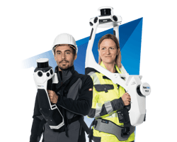
NavVis VLX 3 & NavVis MLX
NavVis VLX 3 & NavVis MLX perfectly complement each other in your toolkit. NavVis VLX 3 is ideal for large, complex environments and NavVis MLX is optimal for small, confined spaces, making no environment too challenging for this dynamic duo to tackle.
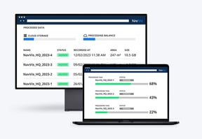
NavVis IVION Processing
Process, geo-register, and automatically align scan data from NavVis VLX 3 and NavVis MLX with survey-grade accuracy. Seamlessly generate point clouds and panoramic images.
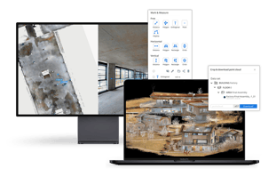
NavVis IVION Core
With NavVis IVION, point clouds and panoramic images are transformed into intelligent spaces accessible from any standard web browser. Create virtual sites or digital twins based on your scanned data, establishing a single source of truth for connected planning and decision-making.
Save time & costs
Find out today how you can get your hands on a NavVis LX-Series bundle by reaching out to our team of experts
Customer testimonials
Find out what our customers have to say about NavVis technology
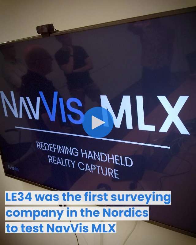
"NavVis VLX has moved us into a confidence in scanning from SLAM technology. We've used it lot for BIM modeling, but also for surveying buildings where we need to define the square meters of it. I think the new NavVis MLX could make at least this aspect easier. It's a good supplement to NavVis technology."
- Anders Møller, Director at LE34
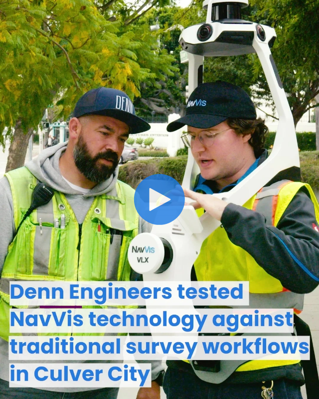
"For boundary and topography, it really is an excellent option. We are able to survey larger amounts of information quickly."
- Michael Walle, Denn Engineers
FAQ
NavVis IVION Processing offers 5 million processing units, enabling seamless and efficient data handling from a variety of NavVis devices. It also features advanced privacy options, such as automated blurring for people and license plates, ensuring compliance and discretion in your datasets.
NavVis IVION Core 25 provides comprehensive data management solutions, offering 1,250 panoramas (covering approximately 25,000 m²) and 150 GB of storage—delivering ample capacity to support all your future projects.
These solutions are designed to meet the diverse and demanding needs of professionals in surveying, laser scanning, and AEC industries, equipping you with powerful tools for data processing and management.
If you already own one or several NavVis VLX devices, the only mandatory software that comes with each additional device is the 3-year license for the NavVis VLX & NavVis MLX System Software.
NavVis IVION Processing and NavVis IVION Core are not required in addition, but you may want to review your business' needs for more processing units or panoramic images in NavVis IVION.
Data security is integral to the development of NavVis IVION Processing for NavVis IVION, designed on top of AWS.
At NavVis, security and privacy are built into the heart of our products and services. For the peace of mind of our customers, partners, and employees, these are the standard safeguards we deploy.
If you would like to order a device, we recommend you contact our sales team. They can answer additional questions you might have and guide you through the ordering process by providing a customized offer that fits your individual business needs.
Every customer who orders a bundle will automatically receive an email once the delivery is on its way, including a tracking link for the order.
Once your NavVis hardware is delivered, you will receive a Welcome Email to schedule your Welcome Call with your Customer Success Manager.
During the Welcome Call, you will cover all important topics, such as training and the usage of our Support Portal.
Depending on the type of the project, some NavVis customers have reported completing up to 90% of their scanning projects with a NavVis VLX. With the addition of NavVis MLX, customers have a complete solution for any environment in which they're scanning.
Yes, you can. By using our integration with IPX’s BIMIT. BIMIT is a modeling service that allows users to order as-built BIM models based on point clouds, providing a high level of confidence in delivery time, quality, and cost, all at a competitive price. This integration can help augment your teams, enabling quicker turnover for scan-to-BIM projects and allowing your team to focus on more value-adding tasks.
Yes, you can upload and merge both, NavVis VLX and NavVis MLX datasets, within the same instance in NavVis IVION. This integration is not only possible but also highly beneficial, as combining these datasets allows you to leverage the unique strengths of each capture device. It enhances the quality and accuracy of the resulting point cloud in NavVis IVION, providing a rich dataset that is highly adaptable for various use cases.
Yes, 2D map and floorplan views are available and automatically generated in NavVis IVION. Using NavVis point cloud data, you can also draft detailed 2D floor plans and elevations of existing indoor sites in CAD, typically at scales of 1:100 or 1:50, as well as create 2D maps for outdoor projects. The high accuracy, low noise levels, and fine detail resolution in the point cloud make it efficient to produce deliverables that meet project requirements. Additionally, NavVis IVION offers seamless navigation through detailed panoramic imagery, helping to resolve any ambiguities in the point cloud representation.
You can import NavVis point cloud data into any BIM modeling tool of your choice. The data’s accuracy, low noise, high resolution, realistic coloring, and panoramic imagery (even more accessible with the NavVis IVION add-in for Autodesk Revit) help users better understand the point cloud and model fine details that might otherwise be hard to identify with confidence. This enables modeling at a typical Level of Development (LOD) 300.
If modeling capacity is limited, you can also leverage the integration of NavVis IVION with BIMIT to quickly calculate the cost and turnaround time for producing a base 3D model—and have it created for you.
What if you already have a model but need to verify it against your latest survey? The BIM model visualization functionality in NavVis IVION enables seamless comparisons between IFC models and point clouds, helping you identify issues before they lead to costly rework and delays.
To complete your construction workflow, NavVis IVION Go allows you to access your digital construction site on the go. Record and categorize key details directly from the field, optimizing project coordination by capturing, organizing, and easily sharing site annotations.
Ready to save?
Reach out to our Sales team today.
Simply fill out the form, and our team will get back to you promptly to help you secure a bundle offer tailored to your needs.
Have more questions? No worries - our experts are here to clarify all the details and assist you in optimizing your workflow and quoting with the NavVis LX-Series bundle.


