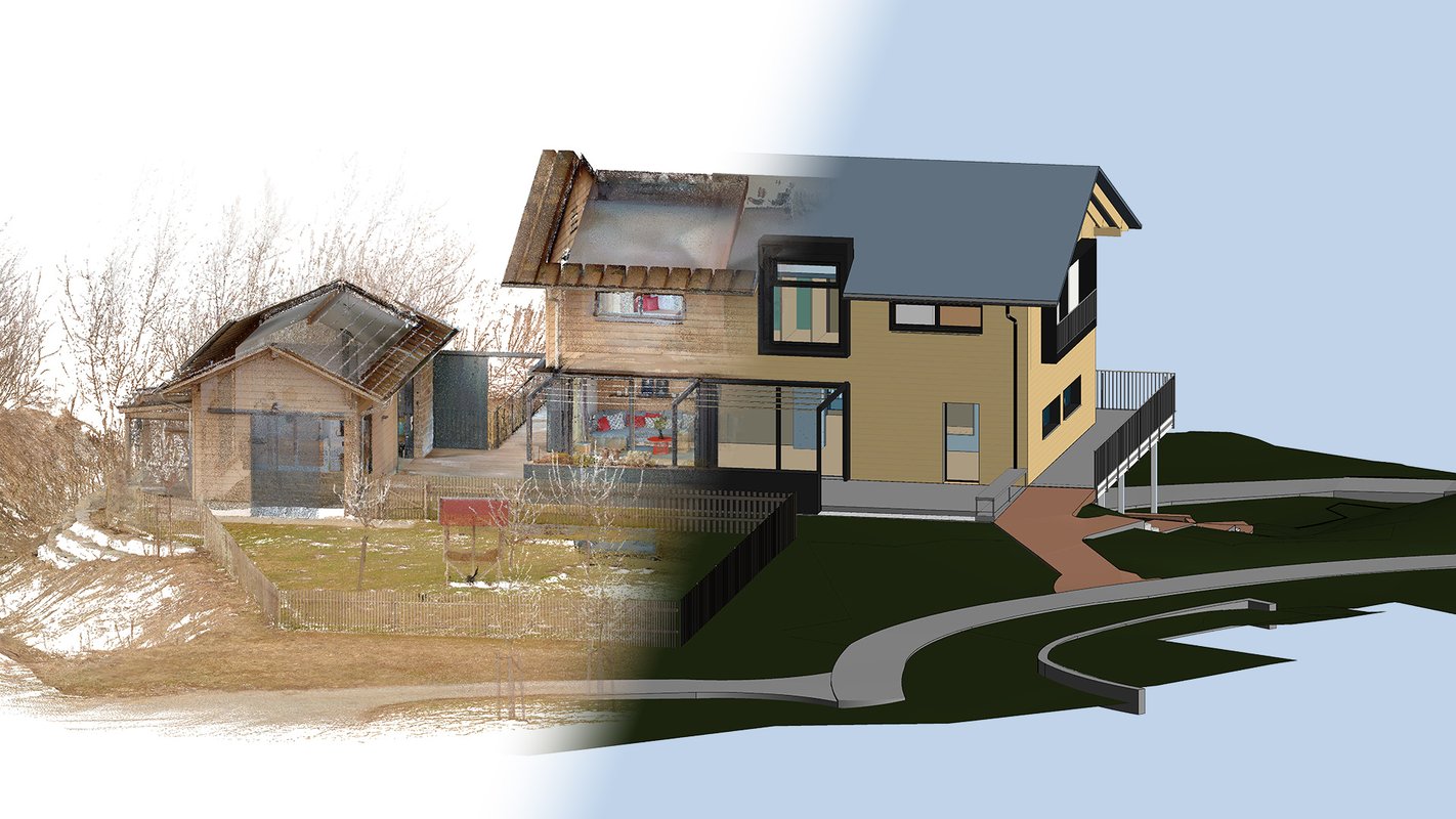
Optimize Your 3D Modeling Workflow with NavVis Technology
From exceptional data quality perfect for modeling, to powerful modeling and verification tools, plus a mobile app for on-the-go access — NavVis technology has everything you need.
Best-in-class data quality for 3D modeling
Import NavVis point cloud data into any BIM modeling tool of your choice. Its accuracy, low noise, high resolution, realistic coloring, and panoramic imagery help users better understand the point cloud and confidently model fine details that would otherwise be difficult to identify. BIM models based on NavVis data are typically delivered at a Level of Development (LOD) 300. And to further simplify your modeling process, we support useful integrations.
.jpg?width=300&name=baufritz-sample-data-banner-SM-and-feature%20(1).jpg)
Don't just take our word for it - see the results for yourself! We offer a curated collection of environments scanned with our NavVis LX-Series, including the wearable NavVis VLX and the handheld NavVis MLX. These datasets allow you to independently evaluate the exceptional point cloud quality now achievable with dynamic scanning.
Download the sample data
Mobile mapping is the go-to solution for fast and efficient data capture. However, do these devices deliver the point cloud quality needed for BIM models and CAD drawings? Find all the answers in this guide.
Access the guideIntegrations to speed up your modeling
Accelerate your inhouse 3D modeling process or outsource model creation to free up capacity.
NavVis integrates with Autodesk products to simplify your BIM workflows
Autodesk provides AEC professionals with software products that facilitate project delivery from early design through to construction. The integration of NavVis IVION with the Autodesk Revit Add-In simplifies your as-built BIM workflow by connecting your projects to realistic 3D visualizations.

NavVis integrates with IPX' BIMIT service to further simplify the BIM modeling creation process
If your modeling capacity is limited, you can leverage the integration of NavVis IVION with Integrated Projects' BIMIT service to quickly calculate the cost and turnaround time for producing a BIM model - and have it created for you.


In this webinar, we will explore the challenges of getting accurate drawings of an existing building and traditional scan-to-BIM services, which are often costly, slow, and fragmented. See how the integration of BIMIT integration with NavVis technology addresses these issues by providing a simple and cost-effective solution for converting NavVis datasets into detailed BIM and CAD models.
3D model verification made simple
Verify the quality of your as-is BIM model
Upload your IFC model, generated from your original scan data, directly into NavVis IVION and compare it to the original point cloud and panoramic 360° images. Verify the generated 3D deliverables to confirm their alignment with the as-is conditions and to ensure compliance with client-specified requirements, including LOD levels and accuracy.
Construction element families make it easy to navigate within the model. You can quickly identify and mark discrepancies directly in your digital site to share them with your BIM/VDC team.

From draft to definition:
The evolution of model visualization in NavVis IVION
Your model is ready, but you need to verify it against your latest survey? The BIM model import and visualization functionality in NavVis IVION makes it easy to align and compare IFC models with point clouds, helping you identify issues and discrepancies at an early stage.
Verify data quality and construction to avoid expensive rework
Easily compare IFC models and point clouds to identify issues before they lead to costly rework and delays.
Evaluate your as-designed models against the as-built conditions of your construction site, annotate issues and easily share with stakeholders, and manage it all within the NavVis IVION platform. This streamlines your construction verification process, saving both time and money on your projects.

"TPI Vermessungsgesellschaft GmbH enjoys collaborating with NavVis. We are happy to contribute our practical experience to the development process, working together to move forward and ultimately deliver a product that adds value to a wide range of projects and customers. The new model visualization feature in NavVis IVION truly has its finger on the pulse of current needs. We are delighted to be part of this project and would like to thank NavVis for their continued trust."
Streamline site inspection to verify your construction
Optimize project alignment anywhere - capture, organize, and access site annotations with NavVis IVION Go.
You're out in the field and want to add more information to your digital site as you inspect it? Use NavVis IVION Go, available to all NavVis IVION users, to stay connected and update your digital representation while on the move. The mobile app now supports field notes, making project data management easier than ever.
Easily capture and categorize essential details - such as text, images, and hyperlinks - directly from the field. Keep your updates organized all in one place and accessible to your entire team for efficient, real-time collaboration with the team back at the office.

NavVis IVION Go makes it easier than ever to take field notes while inspecting your site. Here’s how it transforms your workflow:
- Enable automatic positioning to save time when navigating through your digital site
- Easily capture POIs as you spot them on-site
- Capture, organize, and share annotations to update your site
- Keep all data in one place - accessible in real time to all stakeholders from anywhere
- Optimizes project data management in NavVis IVION Core


