


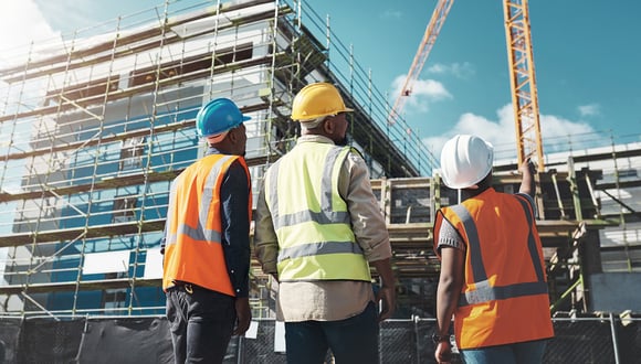
Construction
Optimize your workflows with dynamic reality capture technology that provides reliable as-built data, differentiates you from the competition, boosts efficiency, and reduces costs. Capture anything from small projects and confined spaces to larger, complex environments. Access up-to-date, reliable representations of physical sites for better understanding, planning, and collaboration across the construction lifecycle.
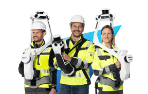
Use NavVis VLX and NavVis MLX alongside any surveying device already in your inventory, whether it's a total station, GNSS rover, terrestrial laser scanner, or an unmanned aerial vehicle.
Continue to operate as you normally would, but better.
NavVis LX-Series
Process, geo-register and automatically align scan data from NavVis devices and other data sources with survey-grade accuracy.
Objects that move through the scan are automatically detected and removed during post-processing.
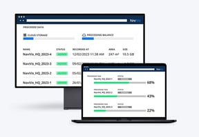
NavVis IVION Processing
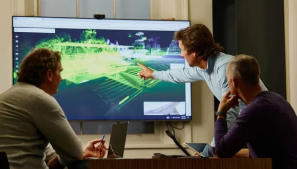
With NavVis IVION Core, point clouds and panoramic images are transformed into intelligent spaces accessible from any standard web browser.
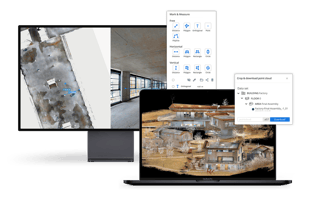
Crop and download data to use in third-party software.
NavVis IVION Core
With NavVis IVION, seamless integration and workflow compatibility are at your fingertips. We offer a full range of downloadable data formats that fit smoothly into existing workflows and third-party solutions. We also simplify the export and import of points of interest (POIs) with universally compatible file formats.
Partners
Architecture & Engineering
Contracting

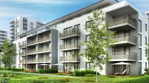
Residential commercial building documentation
Generating 2D and 3D documentation of residential and commercial buildings requires fast, accurate and up-to-date information about a site. Access to the status quo of a site is vital throughout the project lifecycle, from planning to active construction, to completion, and thereafter. Reality capture technology enables this flexibility and eliminates the risks associated with outdated documents, photos, and manual measurements. SLAM-based laser scanning speeds up the documentation of site conditions, enabling more frequent scans, captured accurately for more reliable scan-to-BIM and scan-to-CAD workflows.
Reality capture platforms such as NavVis IVION provide a direct connection between the location and the information on site and include integrations with commonly used software such as Autodesk Revit. Users can leverage time and resource-saving features in NavVis IVION by downloading only the desired point cloud sections they want to work with and having access to high resolution panoramic imagery for modeling and plan generation in third-party software.
Here is some content you might find interesting:
- (Blog | Jun 2024) Mobile mapping: Advancing the possibilities for building documentation
- (Blog | Jan 2023) The rise of mobile mapping in AEC
- (Blog | Mar 2022) Are mobile mapping and commercial real estate a perfect match?
- (Blog | Nov 2021) How as-built capture by AEC firm pb2 is powered by NavVis technology
- (Blog | Sep 2021) Using NavVis VLX on a construction site for as-built documentation
- (Case Study | Feb 2023) Existing Conditions' historic building capture with NavVis VLX
- (Case Study | Sep 2022) IBKS pushes the boundaries of scan-to-BIM in a towering project
- (Sample Data | Nov 2022) Environment: Modern architectural housing - Erkheim, Germany
- (Webinar | Feb 2023) NavVis + IBKS + PointFuse: Pushing the boundaries of scan-to-BIM
- (Podcast | 2023) Episode 01 - Capturing Realities | NavVis Scanning Realities

Site assessment
Site assessment is essential for project development and planning, involving the evaluation of site conditions, understanding the surroundings, assessing existing structures and infrastructure, environmental investigation, regulatory compliance review, researching site history and land use, and engaging with local stakeholders. Site assessment is essential in renovation and brownfield projects by identifying risks early on. Additionally, it enables accurate cost estimation by considering challenges and regulatory compliance expenses.
Multiple site visits by different engineers and architects are required to comprehensively assess the status quo of a site, which can stretch the budget and timeline while risking missed information and misinterpreted structures. NavVis IVION offers an easily accessible platform that provides up-to-date geometrical and visual information about the site for all team members at all times, enabling a holistic understanding of the site and assessment of its conditions.
Here is some content you might find interesting:
- (Blog | Jan 2023) Five ways NavVis IVION takes your AEC mobile mapping to the next level
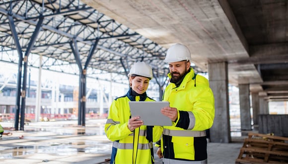
Construction verification
Reality capture data is used to efficiently monitor and verify the execution of construction projects throughout the construction phase. From early risk detection to budget and timing control, it provides a solution to a number of challenges such as potential rework, budget constraints, and complexity restrictions. Data generated from SLAM-based laser scanning systems enable stakeholders to compare 2D and 3D plans and/or models with up-to-date, accurate point cloud data and high-definition panoramic imagery.
Reality capture platforms such as NavVis IVION form a single source of truth for your as-built documentation processes, providing a direct link between location and information. Issues can be flagged, and progress can be monitored to ensure correct project execution and early deficiency detection. Information can be seamlessly shared with contractors and stakeholders across your wider project network.
Here is some content you might find interesting:
- (Blog | May 2024) Monitoring buildings over time with continuous digital scanning
- (Blog | Nov 2022) Can you measure floor flatness with NavVis VLX? We didn’t think so.
- (Blog | Nov 2022) Surveying an extension to Munich Airport during construction
- (Blog | Aug 2021) Reality capture use case: Design and construction verification
- (Podcast | 2023) Episode 02 - Overcoming BIMpossible | NavVis Scanning Realities
- (Podcast | 2023) Episode 01 - Capturing Realities | NavVis Scanning Realities
- (Webinar | Oct 2023) How surveyors and reality capture professionals can win more projects in construction
- (Webinar | Sep 2023) Improving efficiency and reducing rework in construction projects with technology
Collaboration, visualization and site visits
Transparency across the board is key in any construction project. A lack of reliable information about the status quo of a project and poor communication on such complex projects can stall effective collaboration and drastically increase the risk of potential rework and unnecessary resource expenditure that could have been avoided. NavVis IVION enables multiple stakeholders to swiftly and securely access, visualize, and manage up-to-date site information from their web browsers.
This empowers a network of teams and individual stakeholders to make informed decisions about the status quo of a site at any point during the project by providing them with detailed, accurate information that is easily and efficiently accessible.
Here is some content you might find interesting:
- (Blog | Jun 2024) How technology can improve collaboration in construction projects
- (Blog | Jan 2023) Five ways NavVis IVION takes your AEC mobile mapping to the next level
- (Blog | Oct 2022) Collaboration – what is holding the AEC industry back?
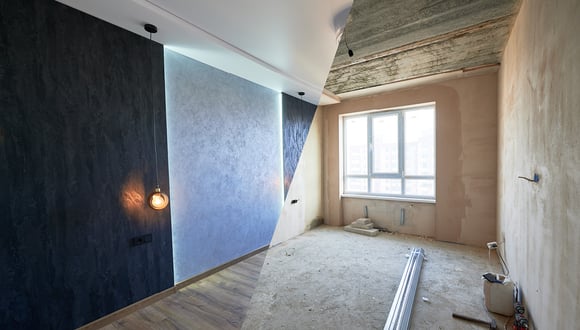
Renovation planning
From improving the energy efficiency of a building structure to repairing materials and structures to prolonging the lifecycle of the existing asset, planning a renovation project is a complex task. Renovation planning currently faces higher project risks due to heightened complexity and a lack of up-to-date information about the actual conditions of a site, even before planning starts. This can lead to unreliable deficit estimations and uninformed decisions, putting a project at risk of costly rework.
Budget and time restrictions associated with visiting renovation sites can also lead to stakeholders relying on outdated documents and second-hand information to make important decisions and risk calculations. From scanning the site to status quo assessment and high-level design concepts, reality capture technology provides renovation project stakeholders with up-to-date, accurate data of a site for optimal planning and information sharing.
Here is some content you might find interesting:
- (Case Study | Jun 2022) Rochsburg Castle: Built over 800 years, surveyed in three weeks

Bidding
Contractors aim to secure contracts by demonstrating their ability to complete projects within budget, on time, and while meeting client requirements. However, they encounter challenges such as strong competition, resource-intensive bid preparation, difficulties in collecting accurate subcontractor offers, and the risk of underbidding. Inaccurate bids often stem from uncertainties and limited knowledge about initial project conditions.
By implementing innovative reality capture solutions such as NavVis, contractors can gain a competitive advantage through the adoption of new technologies, leading to increased project wins. NavVis IVION enables seamless visualization of panoramic imagery and point clouds, empowering multiple different stakeholders and subcontractors to easily access and download data about the initial project conditions, ultimately leading to more accurate and successful bids.
Here is some content you might find interesting:
- (Podcast | 2024) Episode 04 - Modernizing Construction | NavVis Scanning Realities
Construction verification
Reality capture data is used to efficiently monitor and verify the execution of construction projects throughout the construction phase. From early risk detection to budget and timing control, it provides a solution to a number of challenges such as potential rework, budget constraints, and complexity restrictions. Data generated from SLAM-based laser scanning systems enable stakeholders to compare 2D and 3D plans and/or models with up-to-date, accurate point cloud data and high-definition panoramic imagery.
Reality capture platforms such as NavVis IVION form a single source of truth for your as-built documentation processes, providing a direct link between location and information. Issues can be flagged, and progress can be monitored to ensure correct project execution and early deficiency detection. Information can be seamlessly shared with contractors and stakeholders across your wider project network.
Here is some content you might find interesting:
- (Blog | May 2024) Monitoring buildings over time with continuous digital scanning
- (Blog | Nov 2022) Can you measure floor flatness with NavVis VLX? We didn’t think so.
- (Blog | Nov 2022) Surveying an extension to Munich Airport during construction
- (Blog | Aug 2021) Reality capture use case: Design and construction verification
- (Podcast | 2023) Episode 02 - Overcoming BIMpossible | NavVis Scanning Realities
- (Podcast | 2023) Episode 01 - Capturing Realities | NavVis Scanning Realities
- (Webinar | Oct 2023) How surveyors and reality capture professionals can win more projects in construction
- (Webinar | Sep 2023) Improving efficiency and reducing rework in construction projects with technology

Collaboration, visualization and site visits
Transparency across the board is key in any construction project. A lack of reliable information about the status quo of a project and poor communication on such complex projects can stall effective collaboration and drastically increase the risk of potential rework and unnecessary resource expenditure that could have been avoided. NavVis IVION enables multiple stakeholders to swiftly and securely access, visualize, and manage up-to-date site information from their web browser.
This empowers a network of teams and individual stakeholders to make informed decisions about the status quo of a site at any point during the project by providing them with detailed, accurate information that is easily and efficiently accessible.
Here is some content you might find interesting:
- (Blog | Jun 2024) How technology can improve collaboration in construction projects
- (Blog | Jan 2023) Five ways NavVis IVION takes your AEC mobile mapping to the next level
- (Blog | Oct 2022) Collaboration – what is holding the AEC industry back?

Preservation, monitoring & claim management
In construction projects, the main goal is to successfully complete the work in accordance with the terms outlined in the contract. This involves protecting specified items such as historical buildings, existing infrastructure, and third-party properties from any potential damage during the construction phase. Contractors are responsible for overseeing their own work and that of subcontractors, implementing measures to prevent harm to these structures, and preserving evidence or documentation related to the site's condition before, during, and after construction. These evidence preservation measures aim to safeguard against disputes and legal issues by accurately documenting existing conditions and any changes during the construction process.
However, challenges often arise due to insufficient coordination among stakeholders, inadequate documentation of progress, and a lack of monitoring of construction activities. NavVis offers a solution that enables professionals to document the entire construction process, providing access to reliable, up-to-date reality capture data for planning purposes, facilitating communication among stakeholders to ensure compliance with contractual conditions and efficient project completion.
Here is some content you might find interesting:
- (Blog | May 2024) Monitoring buildings over time with continuous digital scanning
- (Podcast | 2024) Episode 04 - Modernizing Construction | NavVis Scanning Realities
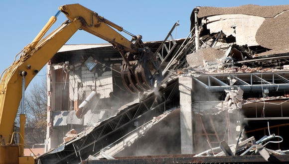
Demolition planning
Demolition planning involves the preparation of execution plans for deconstructing a structure in compliance with environmental and safety regulations. This includes considering factors such as avoiding damage to neighboring buildings and public infrastructure, as well as removing hazardous materials like asbestos with specific techniques. A lack of reliable information about existing site conditions can lead to poor planning and unforeseen problems during execution.
Professional reality capture technologies such as NavVis enable stakeholders to efficiently and accurately capture, visualize, and share existing site conditions, improving planning and coordination amongst project stakeholders.
Here is some content you might find interesting:
- (Case Study | Sep 2021) For an earthquake-damaged castle, reality capture helps reconstruction
- (Case Study | Jun 2021) Reality capture workflows heighten safety in nuclear decommissioning
Resources
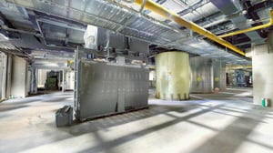
NavVis recently collaborated with ROM Technik and their end customer VARTA AG to scan a multi-story technical building under construction in Nördlingen, Germany. NavVis MLX was used to capture a wide range of spaces within the building and its surroundings.

With governments around the world set to impose tighter restrictions on all industries, buildings will require adaptations to improve their energy efficiency. To address the environmental impact of construction, there is a growing trend for retrofitting and renovation to effectively upgrade older structures rather than demolishing them in favor of building new shells.


In the field of Architecture, Engineering, and Construction, there is a growing emphasis on efficiency, accuracy, and cost-efficiency. This article examines the diverse aspects of architecture, engineering, and construction processes that have been impacted by recent innovations in reality capture.

Learn more about the use of NavVis as a solution within the framework of the Sustainable Sites (SS) credit for site assessment.
